Speeches Shim
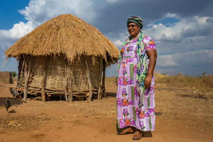
Standing in her compound on the top of a low hill, Chieftainess Mkanda surveys her chiefdom. Mud huts with thatch roofs dot the landscape – and signs of progress abound.
Just beside the road to her compound she points out a new corn mill and sunflower oil press.
In the next village down the hill, there is a new communal fishpond. In another village further along the dirt road, farmers are raising pigs, and everywhere there are young fruit trees, mango, orange, and guava. All of this is a testament to the power of secure land rights and tenure.
The Chieftainess and her community are reaping the rewards of a USAID program that helps communities and community members document their land. The USAID Integrated Land and Resource Governance program relies on a suite of innovative technology tools (MAST) developed by USAID to affordably, efficiently, and transparently map and document land and resource rights. Community members are trained to help each farmer map their land. They walk the perimeter, marking GPS coordinates with handheld devices and record the details of owners and persons of interest. The community approves every parcel’s boundaries and ownership records and also develops a communal map. Each farmer is given a document that maps their land, includes their name, and the Chieftainess’s signature.
The documents have proved transformative for communities – like those within Chieftainess Mkanda’s chiefdom, where previously maintaining order without land documentation was a struggle. The World Bank estimates 90 percent of the agricultural land in sub-Saharan Africa is undocumentedm and this lack of documentation opened the door to greed, says the Chieftainess. Neighbors would try to grab land from neighbors, brothers from brothers, and the powerful from the weak.
“Everyone wants more land,” explained the Chieftainess. “So, they would take advantage of the widow, or orphans. They would make all sorts of claims. And, of course, no one had any proof that the land was theirs, so it was difficult to achieve justice.”
It was common for 20 aggrieved farmers to arrive at her office every day asking her to intervene in disputes over ownership or boundaries. “Before, everyone was always fighting over land,” added the chieftainess “Now that is a thing of the past.”
The newfound security is tangible. Where before farmers were reluctant to invest in their land, lest their investment be claimed by a neighbor; now farmers are building on their land – such as the corn mill – and improving their farms. Where before farmers planted mostly low value crops and kept their guard up; now they are investing in fruit trees and collaborating – such as on the Malajajest Fish Farm, which is a communal effort to improve nutrition.
“Land has been the bottleneck, the barrier that we could never get past,” explained the Chieftainess, a former schoolteacher who was asked to leave her job to assume leadership of Mkanda Chiefdom in Zambia’s Eastern Province on the border with Malawi.
Documenting the land rights of her community hasn’t just reduced conflict and increased investments strengthening her community’s self-sufficiency, it has also helped the community become better stewards for the land.
“Nobody protected trees before,” said Chieftainess Mkanda. “There was extreme deforestation. People could cut any tree they saw. But now, no one will go out onto someone else’s land and start cutting trees.”
As part of the documentation process, the community has set aside land and forest to be protected for the future.
“We recognize that God created the world once and it is done,” said the Chieftainess. “He is not making it bigger for us. We must care for what he has given us.”
The USAID ILRG program seeks to build capacity of local organizations, district and national government, traditional leaders and communities to document land and resource rights, and to use this data to inform land use planning and development decisions. ILRG helps integrate best practices into land and resource policy and legislation through consultative processes. This has included supporting the finalization of Zambia’s national Land Policy process.
ILRG also works with local partners to pilot progressive legislation and regulations that promote community-based management of natural resources. This has included the documentation of customary land rights, as well as implementing community-based elements of the Wildlife Act and Forest Act of 2015. Finally, in the context of decentralization, ILRG is encouraging the engagement of customary leaders in integrated development planning with district authorities.
Comment
Make a general inquiry or suggest an improvement.